I have been working my way through Shelby Foote’s enthralling three-volume Civil War narrative. His skill of storytelling is only enhanced when I imagine his deep, southern voice reading to me. At times, I will read portions or entire chapters aloud for my wife, who also enjoys Foote’s style.
I keep coming back to one passage on the region of Virginia between Washington D.C. and Richmond at the turn of 1862 that is mesmerizing.
Soon now, that hundred miles of Virginia with its glittering rivers and dusty turnpikes, its fields of grain and rolling pastures, the peace of generations soft upon it like the softness in the voices of its people, would be obscured by the swirl and bank of cannon smoke, stitched by the fitful stabs of muzzle flashes, until at last, lurid as the floor of hell itself, it would seem to have been made for war as deliberately as a chessboard was designed for chess. Even the place-names on the map, which now were merely quaint, would take on the sound of crackling flame and distant thunder, the Biblical, Indian, Anglo-Saxon names of hamlets and creeks and crossroads, for the most part unimportant in themselves until the day when the armies came together, as often by accident as on purpose, to give the scattered names a permanence and settle what manner of life the future generations were to lead. The road ran straight, a glory road with split-rail fences like firewood ready stacked for the two armies, and many men would travel it wearing Union blue or Confederate gray. Blood had been shed along it once, and would be shed again; how many times?
Neither Lincoln nor Davis knew, but they intended to find out, and soon. The year just past had been in the nature of a prelude, whose close marked only the end of the beginning. ((Shelby Foote, The Civil War: A Narrative; Fort Sumter to Perryville (New York: Vintage Books, 1986), 166-167.))
Foote invokes Churchill at the end, but this is one of the few instances I have read where it was not necessary. Foote’s writing stands on its own, as he describes the landscape of a region 150 years ago right before it had seen the worst of the war. I only wish more Civil War books read this well.
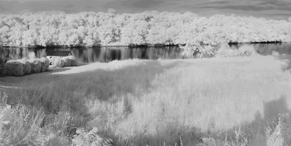
Speaking of quaint names on a map, below is a shot from Fredericksburg. Facing north, this photo captures one of the crossing points by the Army of the Potomac across the Rappahannock River during the Battle of Fredericksburg (December 11-15, 1862). Photograph courtesy of Dawn Manning.

